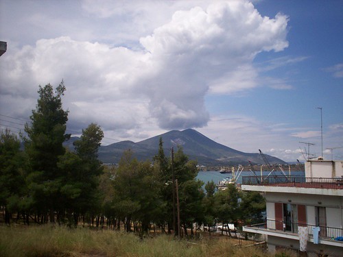
Last weekend I shot this nice Cumulonimbus (Cb) cloud hovering above the low mount of Htypas (~800-900m) over my hometown of Chalkida. Happily, after my sister 's logs mentioned that the last drop of rain having fallen on April 4th (as a tennis instructor, Katerina keeps a log book with the days not having worked because of rain), the rainy weather was highly anticipated, especially after the last weeks' heat.
All weekend was in very unstable weaher conditions. While in one region of the country was cloudy for the most of the day, some others were experiencing light rain, heavy rain with lightnings and some others, hail. Even these local conditions varied a lot just a few kilometers away: Chalkida 's center received 14mm of rain during the weekend, 1,5 km away this dropped to 10,5mm, while the Vasiliko region 10km to the south- east of the city, scored just 4 mm of rain. If one was able to look the precipitation forecast of Poseidon or meteorologia.gr, he could describe the map as if the country had got measles on the face, such were the colours describing the rain over Greece.
The instability is typical on spring time, because the now-warming masses of air are still trying to replace the cool ones very rapidly, while the earth 's capacity has still a lot of cold to give. Another usual phenomenon as the warm air begins to penetrate more and more to northern latitudes, is the drift of huge sand clouds from Sahara desert above the Meditteranean that easily reach the coasts over Southern Europe, creating muddy rain and mud-stained cars (and Vespas, of course).